-45%   PREISAKTION

Fototapete: Satellite map of odense municipality. it is a danish municipality

Fototapete Satellite map of Odense Municipality. It is a Danish municipality (kommune) in Region of Southern Denmark on the island of Funen in central Denmark. Map of streets and buildings of the town center.
Fototapete:
Satellite map of Odense Municipality. It is a Danish municipality (kommune) in Region of Southern Denmark on the island of Funen in central Denmark. Map of streets and buildings of the town center..
Autor: ©
Nr. des Fotos:
#163918110
Andere Themen:
topview, Bezirk, Stadtplan, atlas, Luftbild, Ministerium, Wahrzeichen, Ziel, Gebäude
Vorschau des Zimmers
Ähnlich
Satellite view of the Piedmont region. Italy. 3d render. Physical map of Piemonte, plains, mountains, lakes, mountain range of the Alps
Satellite map of Dubai and surrounding areas, United Arab Emirates. Map roads, ring roads and highways, rivers, railway lines. Transportation map
Mappa satellitare di Nashville, Tennessee, Usa, strade della città. Stradario e mappa del centro città
Satellite view of the Friuli-Venezia Giulia region. Italy. 3d render. Physical map of Friuli-Venezia Giulia , plains, mountains, lakes, mountain range of the Alps
Satellite map of Milan, zones and municipalities. Streets of the Lombard capital. Lombardy. Italy
Satellite map of Province of Cagliari towns and roads, buildings and connecting roads of surrounding areas. Sardinia region, Italy. Sardegna. Map roads, ring roads
Satellite map of Province of Messina towns and roads, buildings and connecting roads of surrounding areas. Sicily region, Italy. Sicilia. Map roads, ring roads
Satellite map of Graz, it is the capital of Styria and the second-largest city in Austria after Vienna. Map of streets and buildings of the town center. Europe
Satellite view of the Sicily region. Italy. 3d render. Physical map of Sicilia, plains, mountains, lakes, mountain range
Satellite view of the Liguria region. Italy. 3d render. Physical map of Liguria, plains, mountains, lakes, mountain range of the Alps
Satellite view of the Piedmont region. Italy. 3d render. Physical map of Piemonte, plains, mountains, lakes, mountain range of the Alps
Satellite map of Dammam. It is the capital of the Eastern Province of Saudi Arabia. Map of streets and buildings of the town center. Asia
Satellite map of Marseille and buildings, France. Map roads, ring roads and highways, rivers. Transportation map
Satellite map of São Paulo, Sao Paulo, it is the most populous city in Brazil. South America. Map of streets of the town center
Mappa satellitare di Boston, Massachusetts, strade cittadine. Mappa stradale, centro città. Stati Uniti d'America
Mappa satellitare di Ginevra, Svizzera, strade della città. Stradario e mappa del centro città
Satellite map of Dubai, United Arab Emirates, city streets. Streets map of the city center
Satellite map of principality of Monaco, Monte Carlo. Fontvieille, Monaco-Ville, La Condamine. Map of streets and buildings of the town center. Europe
Satellite view of the Sardinia region. Italy. 3d render. Physical map of Sardegna, plains, mountains, lakes, mountain range
Satellite map of province of Bolzano, towns and roads, buildings and connecting roads of surrounding areas. Trentino Alto Adige, Italy. Map roads, ring roads
Satellite map of Paris, the capital and most populous city of France. Division of the city into areas,  arrondissement, municipalities. Streets of the capital. France
Satellite view of the Veneto region. Italy. 3d render. Physical map of Veneto, plains, mountains, lakes, mountain range of the Alps
Satellite view of the Emilia-Romagna region. Italy. 3d render. Physical map of Emilia-Romagna, plains, mountains, lakes, mountain range of the Apennines
Satellite view of the Veneto region. Italy. 3d render. Physical map of Veneto, plains, mountains, lakes, mountain range of the Alps
Satellite map of Salzburg. It is the fourth-largest city in Austria and the capital of the Federal State of Salzburg. Map of streets and buildings of the town center
Satellite map of Krakow, it is the second largest and one of the oldest cities in Poland.  Map of streets and buildings of the town center. Europe
Satellite map of Kinshasa (Leopoldville), is the capital and the largest city of the Democratic Republic of the Congo. Streets map and city center.
Mappa satellitare di Cincinnati, Ohio, strade cittadine. Mappa stradale, centro città. Stati Uniti d'America
Mappa satellitare di Dublino, Irlanda, strade della città. Stradario e mappa del centro città
Satellite map of Province of Salerno towns and roads, buildings and connecting roads of surrounding areas. Campania region, Italy. Map roads, ring roads
Satellite map of Province of Caserta towns and roads, buildings and connecting roads of surrounding areas. Campania region, Italy. Map roads, ring roads
Satellite map Trieste, towns and roads, buildings and connecting roads of surrounding areas. Friuli-Venezia Giulia, Italy. Map roads, ring roads
Satellite map of province of Vicenza, towns and roads, buildings and connecting roads of surrounding areas. Veneto, Italy. Map roads, ring roads
Satellite map of province of Treviso, towns and roads, buildings and connecting roads of surrounding areas. Veneto, Italy. Map roads, ring roads
Satellite map of province of Trento, towns and roads, buildings and connecting roads of surrounding areas. Trentino Alto Adige, Italy. Map roads, ring roads
Satellite map of Washington D.C. and buildings, Usa. Map roads, ring roads and highways, rivers. Transportation map
Satellite map of Los Angeles, streets, California, Usa. Map roads, ring roads and highways, rivers. Transportation map
Satellite map of Boston and surrounding areas, Usa. Map roads, ring roads and highways, rivers, railway lines. Transportation map
Satellite map of Berlin and surrounding areas, Germany. Map roads, ring roads and highways, rivers, railway lines
Satellite map of Recife, it is is the fourth-largest urban agglomeration in Brazil. Map of streets and buildings of the town center. South America
Satellite map of Cairo, it is the capital of Egypt, associated with ancient Egypt, as the famous Giza pyramid complex. The city is situated on the Nile river. Map of streets and buildings of the town
Mappa satellitare di Brasilia, Brasile, strade della città. Stradario e mappa del centro città. Sud America
Mappa satellitare di Santiago del Cile, Cile, strade della città. Stradario e mappa del centro città. Sud America
Mappa satellitare di Lima, Peru, strade della città. Stradario e mappa del centro città. Sud America
Mappa satellitare di Vientiane, Laos, strade della città. Stradario e mappa del centro città. Asia
Physical map and satellite view of Sicily region, Italy. Volcano, Etna. 3d render
Satellite map of Yerevan. It is the capital and largest city of Armenia. Situated along the Hrazdan River. Map of streets and buildings of the town center. Asia
Satellite map of Szczecin, it is the capital and largest city of the West Pomeranian Voivodeship in Poland. Map of streets and buildings of the town center. Europe
Satellite map of Yokohama. It is the second largest city in Japan by population, and the most populous municipality of Japan. Map of streets and buildings of the town center. Asia
Satellite map of Poznań, it is a city on the Warta River in west-central Poland. Map of streets and buildings of the town center. Europe
Satellite map of Thessaloniki, it is is the second-largest city in Greece. Map of streets and buildings of the town center. Europe
Satellite map of Bilbao, it is a city in northern Spain, the largest city in the province of Biscay and in the Basque Country. Map of streets and buildings of the town center. Europe
Satellite map of Doha the capital and most populous city of the State of Qatar. Map of streets and buildings of the town center. Asia
Satellite map of Izmir. It is a metropolitan city in the western extremity of Anatolia and the third most populous city in Turkey. Map of streets and buildings of the town center. Asia
Mappa satellitare di Detroit, Michigan, Stati Uniti. Strade della città. Stradario e mappa del centro città
Mappa satellitare di Kuala Lumpur, Malesia, strade della città. Stradario e mappa del centro città
Mappa satellitare di Minneapolis, Minnesota, Usa, strade della città. Stradario e mappa del centro città.
Mappa satellitare di Atlanta, Georgia, Usa, strade della città. Stradario e mappa del centro città
Mappa satellitare di Memphis, Tennessee, Usa, strade della città. Stradario e mappa del centro città
Mappa satellitare di Pittsburgh, in Pennsylvania, strade della città. Mappa stradale, centro città. Stati Uniti d'America
Satellite map of Tehran, Iran, city streets. Street map, city center. Buildings
Italian Alpine Arch and Northern Italy, satellite view. Aerial view of the north of the peninsula. Mountains, lakes and plains. Hand drawing. Physical map. 3d render
Satellite map of Izmir. It is a metropolitan city in the western extremity of Anatolia and the third most populous city in Turkey. Map of streets and buildings of the town center. Asia. Earthquake
Italian Alpine Arch and Northern Italy, satellite view. Aerial view of the north of the peninsula. Mountains, lakes and plains. Physical map. 3d render.
Italian Alpine Arch and Northern Italy, satellite view. Aerial view of the north of the peninsula. Mountains, lakes and plains. Physical map. 3d render
Mappa satellitare di Asuncion, Paraguay, strade della città. Stradario e mappa del centro città. Sud America
Mappa satellitare di Yangon, Myanmar, strade della città. Stradario e mappa del centro città. Asia
Satellite view of the Campania region. Italy. 3d render. Physical map of Campania, plains, mountains, lakes, mountain range of the Apennines
Satellite view of the Lazio region. Italy. 3d render. Physical map of Lazio, plains, mountains, lakes, mountain range of the Apennines
Satellite view of the Calabria region. Italy. 3d render. Physical map of Calabria, plains, mountains, lakes, mountain range of the Apennines
Satellite view of the Trentino-Alto Adige region. Italy. 3d render. Physical map of Trentino-Alto Adige, plains, mountains, lakes, mountain range of the Alps
Satellite view of the Umbria region. Italy. 3d render. Physical map of Umbria, plains, mountains, lakes, mountain range of the Apennines
Satellite view of the Marche region. Italy. 3d render. Physical map of Marche, plains, mountains, lakes, mountain range of the Apennines
Satellite view of the Puglia region. Italy. 3d render. Physical map of Puglia, plains, mountains, lakes, mountain range
Satellite view of the Molise region. Italy. 3d render. Physical map of Molise, plains, mountains, lakes, mountain range of the Apennines
Satellite view of the Abruzzo region. Italy. 3d render. Physical map of Abruzzo, plains, mountains, lakes, mountain range of the Apennines
Satellite view of the Valle d’Aosta region. Italy. 3d render. Physical map of Aosta valley, plains, mountains, lakes, mountain range of the Alps
Satellite view of the Basilicata region. Italy. 3d render. Physical map of Basilicata, plains, mountains, lakes, mountain range of the Apennines
mehrAusblenden
Produktbeschreibung

Vinyl-Fototapete

Die Vinyl-Fototapete wird auf einem robusten Untergrund mit glatter, matter Oberfläche gedruckt. Dank der HP Latex-Tuschen bleiben die Farben der Fototapete viele Jahre lang intensiv.

  • ✓ Robust gegen Verformungen und Ausdehnen
  • ✓ Wasserdampfdurchlässig
  • ✓ Einfache Montage
  • ✓ Umweltfreundliche HP Latex-Tusche

Maximale Streifenbreite: 95-105 cm. Wenn die Abmessungen die maximale Breite übersteigen, setzt sich der Ausdruck aus mehreren gleich großen Bögen zusammen
Anwendungsbereich: glatte, ebene Wände
Klebemethode: Der Klebstoff wird ausschließlich auf die Wand aufgebracht, anschließend werden die einzelnen Streifen Kante an Kante aufgeklebt; so wird das Risiko einer Beschädigung der Tapete minimiert und die Lage kann leicht korrigiert werden
Reinigungsmethode: trockenes Tuch
Oberfläche: halbmatt


Abwischbare Vinyl-Fototapete

Die abwischbare Vinyl-Fototapete wird auf einem robusten Untergrund mit glatter, matter Oberfläche gedruckt. Anschließend wird sie laminiert, um sie gegen Feuchtigkeit und die negativen Folgen äußerer Einflüsse (Kratzer, Abrieb, Sonneneinstrahlung) zu schützen. Die moderne HP Latex-Drucktechnologie sorgt langfristig für lebendige Farben.

  • ✓ Laminiert
  • ✓ Robust gegen Feuchtigkeit, Kratzer, Abrieb und Sonneneinstrahlung
  • ✓ Robust gegen Verformungen und Ausdehnen
  • ✓ Wasserdampfdurchlässig
  • ✓ Einfache Montage
  • ✓ Umweltfreundliche HP Latex-Tusche

Maximale Streifenbreite: 95-105 cm. Wenn die Abmessungen die maximale Breite übersteigen, setzt sich der Ausdruck aus mehreren gleich großen Bögen zusammen
Anwendungsbereich: glatte, ebene Wände. Räume mit großer Feuchtigkeit (Küche, Bad) bzw. Wände, die leicht verkratzt werden können (Flur, Kinderzimmer, Hotel, Restaurant, Konferenzsaal, öffentliche Gebäude, Schulen, Kindergärten, Krippen)
Klebemethode: Der Klebstoff wird ausschließlich auf die Wand aufgebracht, anschließend werden die einzelnen Streifen Kante an Kante aufgeklebt; so wird das Risiko einer Beschädigung der Tapete bei Renovierungsarbeiten minimiert und die Lage kann leicht korrigiert werden
Reinigungsmethode: feuchtes Tuch
Oberfläche: halbmatt


Vinyl-Strukturtapete

Die Vinyl-Strukturtapete wird auf einem robusten Untergrund mit Feinsandstruktur gedruckt. So wird der Eindruck besonderer Tiefe hervorgerufen. Die HP Latex-Technologie sorgt langfristig für ausdrucksstarke Farben.

  • ✓ Feinsandstruktur
  • ✓ Robust gegen Verformungen und Ausdehnen
  • ✓ Wasserdampfdurchlässig
  • ✓ Einfache Montage
  • ✓ Umweltfreundliche HP Latex-Tusche

Maximale Streifenbreite: 100 cm. Wenn die Abmessungen die maximale Breite übersteigen, setzt sich der Ausdruck aus mehreren gleich großen Bögen zusammen
Anwendungsbereich: glatte, ebene Wände. Die Fototapete ist sowohl für Wohnräume, als auch für Restaurants, Schulen und Büros geeignet
Klebemethode: Der Klebstoff wird ausschließlich auf die Wand aufgebracht, anschließend werden die einzelnen Streifen Kante an Kante aufgeklebt; so wird das Risiko einer Beschädigung der Tapete minimiert und die Lage kann leicht korrigiert werden
Reinigungsmethode: trockenes Tuch
Oberfläche: halbmatt, Feinsandstruktur


Abwaschbare Struktur-Vinylfototapete

Die Vinyl-Strukturtapete wird auf einem robusten Untergrund mit Feinsandstruktur gedruckt. So wird der Eindruck besonderer Tiefe hervorgerufen. Die HP Latex-Technologie sorgt langfristig für ausdrucksstarke Farben.

  • ✓ Laminiert
  • ✓ Feinsandstruktur
  • ✓ Robust gegen Feuchtigkeit, Kratzer, Abrieb und Sonneneinstrahlung
  • ✓ Robust gegen Verformungen und Ausdehnen
  • ✓ Wasserdampfdurchlässig
  • ✓ Einfache Montage
  • ✓ Umweltfreundliche HP Latex-Tusche

Maximale Streifenbreite: 100 cm. Wenn die Abmessungen die maximale Breite übersteigen, setzt sich der Ausdruck aus mehreren gleich großen Bögen zusammen
Anwendungsbereich: glatte, ebene Wände. Räume mit großer Feuchtigkeit (Küche, Bad) und Wände die leicht verkratzt werden können (Flur, Kinderzimmer, Hotel, Restaurant, Konferenzsaal, öffentliche Gebäude, Schulen, Kindergärten, Krippen)
Klebemethode: Der Klebstoff wird ausschließlich auf die Wand aufgebracht, anschließend werden die einzelnen Streifen Kante an Kante aufgeklebt; so wird das Risiko einer Beschädigung der Tapete bei Renovierungsarbeiten minimiert und die Lage kann leicht korrigiert werden
Reinigungsmethode: feuchtes Tuch
Oberfläche: halbmatt, Feinsandstruktur


Selbstklebende Fototapete

Dank des vielseitigen Anwendungsbereichs eignet sich das Produkt hervorragend für verschiedene Räumen und auf unterschiedlichen Flächen.

Selbstklebende Fototapeten sind die richtige Wahl für Wände, Schränke, Fensterscheiben, Möbel und andere glatte Flächen. Die ausdrucksstarken, lebendigen Farben sind dank der HP Latex-Technologie über viele Jahre hinweg garantiert.

  • ✓ Ohne zusätzlichen Klebstoff
  • ✓ Sehr einfache und schnelle Montage
  • ✓ Robust gegen Verformungen und Ausdehnen
  • ✓ Wasserdampfdurchlässig
  • ✓ Umweltfreundliche HP Latex-Tusche

Maximale Streifenbreite: 133 cm. Wenn die Abmessungen die maximale Breite übersteigen, setzt sich der Ausdruck aus mehreren gleich großen Bögen zusammen
Anwendungsbereich: glatte Flächen, vielseitig anwendbar
Klebemethode: Kante an Kante
Reinigungsmethode: feuchtes Tuch
Oberfläche: halbmatt


mehrAusblenden
Siehe auch
Atomic Fukushima Daiichi Kernkraftwerk in der Nacht
Öl -Raffinerie-Anlage
Öl-Raffinerie
Ölquellen
Öl-Raffinerie
Italien Karte 3d körperliche
Pianeta luci terra Sole Luna
Flugzeug auf Kurs
Dracula Schloss und Berge
Fontana Pizzo Calabro acqua
Fukushima Daiichi Nuclear Power Station Atomic Uhr
Cartin Europa bosco grün alberi
Crepe Erdbeben Boden Strada freccia
Herz Blumen Zusammensetzung
Strada ponte Stute cielo
Der menschliche Körper Skelett Wirbelsäule
X -ray das menschliche Skelett und Körper
Atleti su podio con Coppa
Aereo Stute montagna vacanze viaggi
Atleti sind podio
Podio atleti
Gehirn- Anatomie des menschlichen Kopfes
Intestino Nehmens umano scheletro raggi x
Titanic 100 anni anniversario Eisbergs
Cartina Regione Lombardia
Cartina Regione Lombardia Provinz
Berge Gipfel Seen Wasser
Isola, faraglione, roccia, mare, Palma
Deserto, Sahara, Dünen
Fiori Bianchi terreno sezione erba
Isola Vulkan Lava
Recycling Mülleimer
Herren Skeleton Rennen
Corpo e umano scheletro in corsa
Corpo umano E scheletro in corsa
Blumen rot, lila, orange gras Abschnitt
Rose Rosengarten Schliff
Gelbe Löwenzahnblüten
Fiori viola terreno sezione Erba
Regione Emilia Romagna terremoto Italia
Emila Romagna Erdbebenregion Abschnitt
Arm und Hand x -ray
Muscoli e donna scheletro
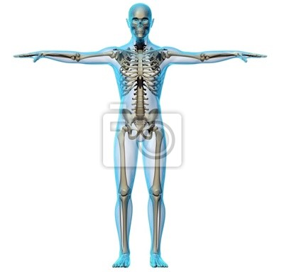
Mann und Skelett
Intestino scheletro Nehmens umano raggi x
Fässer mit Atommüll
Ökologische Haus saubere Energie
Weihnachts-Grußkarte
Herbstwald
Menschlichen Körper Skelett Darm
Castelllo Torri tramonto
Taste Sucher
Salva Euro salvagente Moneta
Vulcano 3d angeblichen
Strada Desert Truck
Vulcano 3d angeblichen
Scheletro und Körper Uman
X -ray menschlicher Körper und Skelett
Isola ein cuore barca Stute
Blätter -Blatt-Papierverkaufs
Sonnensystem Planeten
Männlich Skelett in Knieschmerzen Lauf
Mondo Land Zentrum Egozentrismus
Mondo Globi egocentrismo Pluriball
Menschliche Gehirn Anatomie Kopf
Italien Europa physikalische Karte
Vulcano esplosione sezione terreno Eruzione
Testa Viso anatomia
Israel Map 3D Terrorismusbekämpfung
Testa Corporate anatomia faccia
Israel 3D-Kartenzusammenstöße
Testa Viso cervello
Onde formazione oceano Stute
Skelett und menschlichen Körper X -ray
Testa Viso cervello
Italien Map 3D Wahl, Abstimmung,
Moai der Osterinsel
mehrAusblenden

Unser Online-Shop verwendet Cookies und ähnliche Technologien. Diese werden eingesetzt, um Ihnen die höchste Servicequalität zu bieten und den reibungslosen Betrieb der Website zu garantieren. Mit Ihrer Zustimmung werden Cookies auch zur zusätzlichen Messung und Analyse der Nutzung der Website verwendet. So können wir die Website an Ihre Interessen anpassen und Ihnen personalisierte Inhalte und Werbung anzeigen.
Der Administrator Ihrer Daten ist Fairbox Sp. z o.o., und in bestimmten Situationen auch unsere Partner, mit denen wir zusammenarbeiten. Ausführliche Informationen zur Verwendung von Cookies und zur Verarbeitung Ihrer personenbezogenen Daten finden Sie in unserer Datenschutz- und Cookie-Erklärung.
Cookie-Einstellungen
Nachfolgend finden Sie Beschreibungen der einzelnen Kategorien von Cookies und die Möglichkeit, diese an Ihre Präferenzen anzupassen:
Essenziell
Wir verwenden essenzielle Cookies, um sicherzustellen, dass die Website ordnungsgemäß funktioniert. Sie ermöglichen es Ihnen, ohne Unterbrechung in unserem Shop zu stöbern und sicher einzukaufen.
Funktional
Funktionale Cookies werden verwendet, um die von den Benutzern auf der Website getroffenen Entscheidungen zu speichern, was hilft, die Website an Ihre persönlichen Vorlieben anzupassen und die Benutzererfahrung zu verbessern.
Analytisch
Analytische Cookies messen die Anzahl der Besuche und sammeln Informationen über die Traffic-Quellen. Sie ermöglichen es uns, zu verstehen, wie Benutzer die Website verwenden, die Qualität des Dienstes zu verbessern und den Inhalt des Online-Shops anzupassen, um die Erwartungen unserer Kunden zu erfüllen.
Marketing
Marketing-Cookies ermöglichen es uns und unseren Partnern, Werbeinhalte auf Ihre Interessen abzustimmen. Sie werden auch dazu verwendet, Werbung auf anderen Websites anzuzeigen.